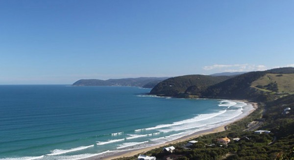
The Great Ocean Road Coast Committee (GORCC) is a Committee of Management (CoM) formed by the Victorian Government in 2004 as a result of the amalgamation of five previous CoMs along the coast in the Surf Coast Shire (i.e. Torquay, Anglesea, Aireys Inlet, Fairhaven, Lorne). It manage 37 kilometres of coastal Crown land reserves along the heritage listed Great Ocean Road between Point Impossible east of Torquay and Cumberland River south of Lorne (see map below).
These coastal reserves generally encompass the narrow strip of foreshore between low water mark and the nearest road (eg the Great Ocean Road) around the more developed sections of coast (eg existing settlements). GORCC also manages the Port of Lorne and Queens Park in Lorne and Taylor Park in Torquay. Combined, these areas constitute approximately 540 hectares, most of which is reserved for ‘protection of the coast’ or for ‘public purposes’, with a smaller amount reserved for ‘recreation’. All the areas are managed for appropriate recreational use whilst minimising impacts on remnant values and the coastal environment. GORCC does not own these areas – they are owned by the state of Victoria – GORCC is responsible for their management on behalf of the state and for the use and enjoyment of the community.
Like other CoMs, the Committee Members of GORCC are appointed under the Crown Land (Reserves) Act 1978 for a term of three years by the Minister for Environment and Climate Change, and are selected through a public, skills-based Expression of Interest process.
In our district GORCC manages coastal strips that run from the western end of Eastern View to Sunnymead at the north eastern end of Aireys Inlet, encompassing the areas outlined in red in the sections shown below (the management of the areas within dotted outlines are currently in the process of being transferred from the Department of Sustainability and Environment (DSE) to GORCC). Click on each map to show larger images.
In 2013 GORCC released a new Coastal Management Plan (CMP) to identify priorities and provide direction for the sustainable management of the areas it controls over the following five years. CMPs are developed under the Victorian Coastal Management Act 1995 as the key tool for setting out the land management requirements for a section of the coast. This CMP will be the key overarching document used for managing the GORCC managed coast and will inform the development and/or revision of other supporting plans and documents in the future.
In the plan GORCC has identified four significant, high level challenges for managing the coast: ‘climate change; population and development; protection of the natural environment; and financial and other resources’. In addition GORCC has developed a long term vision to guide management of the coast in the long term: ‘Protect and enhance the breath taking and iconic coastline with its diverse community, natural environment and rich social and cultural history as custodians for current and future generations’.
Furthermore, the plan identifies overall objectives and priority actions for implementing the Strategic Framework and managing the coast over the next five years. Significant actions involve:
• Establishing a long term environmental monitoring program.
• Preparing new masterplans to direct day-to-day management of specific areas along the coast.
• Developing a strategy to manage car park demand and access.
• Researching the use and carrying capacity of coastal Crown land.
• Planning for adapting to the impacts of climate change.
• Expanding the involvement of stakeholders in management of the coast.
AIDA committee member Gary Johnson served on the Community Reference Group that provided community input during preparation of the draft plan. He and other AIDA committee members also provided written and verbal feedback on the draft plan during the community consultation period that finished on 29th June 2012. The photo below shows AIDA members with GORCC representative Simon Coverdale (far right) at a public consultation at the Angelsea Community Centre.