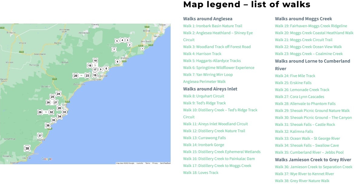
One of AIDA’s major aims is to promote our area as a destination for nature-based tourism that offers a variety of walking experiences including our beaches, cliff platforms, wetlands, estuary and river, and bush trails in the National and Forest Parks of the hinterland.
You can find details of 39 walks in the Great Otway National Park on the Friends of Eastern Otways Walks page.
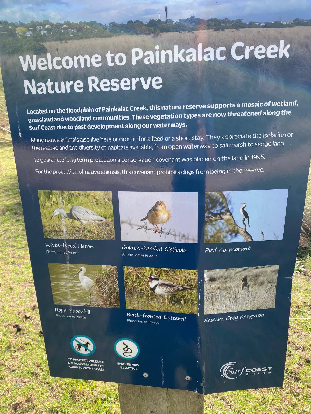
Painkalac Creek Nature Reserve walk
This gentle walk along a gravel track and a wide mown grass track lets you explore this nature reserve containing a mosaic of wetland, grassland and wooded communities. These vegetation types are now threatened along the Surf Coast due to past development along our waterways.
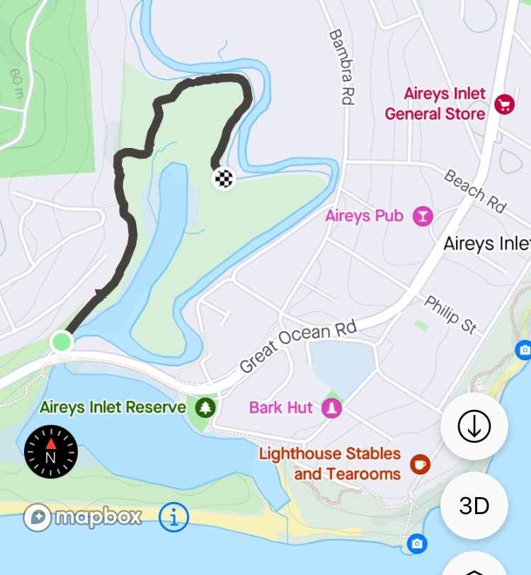
The walk begins in the carpark on the northern side of the Great Ocean Road next to the bridge crossing the Painkalac Creek. Walk past the gate along the gravel path until you reach the sign providing some details of the Nature Reserve.
Continue along the wide mown track to the end which is 1.3 km from the start. Enjoy the variety of flora and fauna that can be seen and return back the way you came to the start of the walk.
The Surf Coast Walk
There are three sections of the Surf Coast Walk that take in the delights of Aireys Inlet and Fairhaven:
Urquhart Bluff to Sunnymead – 3km
Aireys Clifftops – Sunnymead to Aireys Lighthouse 2.80km
Lighthouse Discovery – Aireys Lighthouse to Fairhaven 2.10km
The links above take you to a map and details of each section.